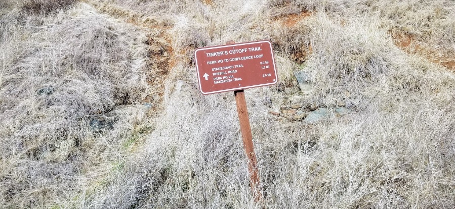
Tinker’s Cutoff Trail
This single file trail offers an alternative route to and from Stagecoach Trail from the confluence area.
This single file trail offers an alternative route to and from Stagecoach Trail from the confluence area. It follows a creek drainage through a tree-lined riparian area with a small pool and waterfall that lasts year round. It is a popular cut off for hikers in the summer months, providing welcome shade that is not always found on Stagecoach Trail.
- Distance 0.3 miles one way
- Approx length of time ¾ hour (hiking)
- Difficulty Moderate to difficult. Both top and bottom sections have been severely rutted by unauthorized bicycle use.
- Website Tinker's Cutoff Trail
- Best Feature Just before the trail turns sharply left and away from the creek, not far below Stagecoach Trail, there is an opening on the right where there is a small, pleasant waterfall in the creek.
- Hiking
- Waterfall
- Creek

The trailhead is 1¾ miles south of ASRA Park Headquarters in the confluence area. Take Hwy 49 from Auburn south to Old Foresthill Road at the bottom of the canyon. Park as close to the Hwy 49 Bridge to Cool as allowed. This unmarked trailhead is almost directly opposite the Hwy 49 Bridge on the Placer County or north side of the river. Looking uphill a clear, sharp cut in the bank is visible. The trail may also be accessed off of Stagecoach Trail. The upper trailhead for Tinker’s Cut Off is just a little less than 1 mile from the confluence via Stagecoach Trail.
ALSO CHECK OUT:
-
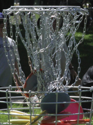
Rocklin Disc Golf Course
Rocklin, CA5480 5th Street, Rocklin, CA 95677Excellent mix of long and medium holes meandering through mature oaks with a creek that comes into play on several holes.
-
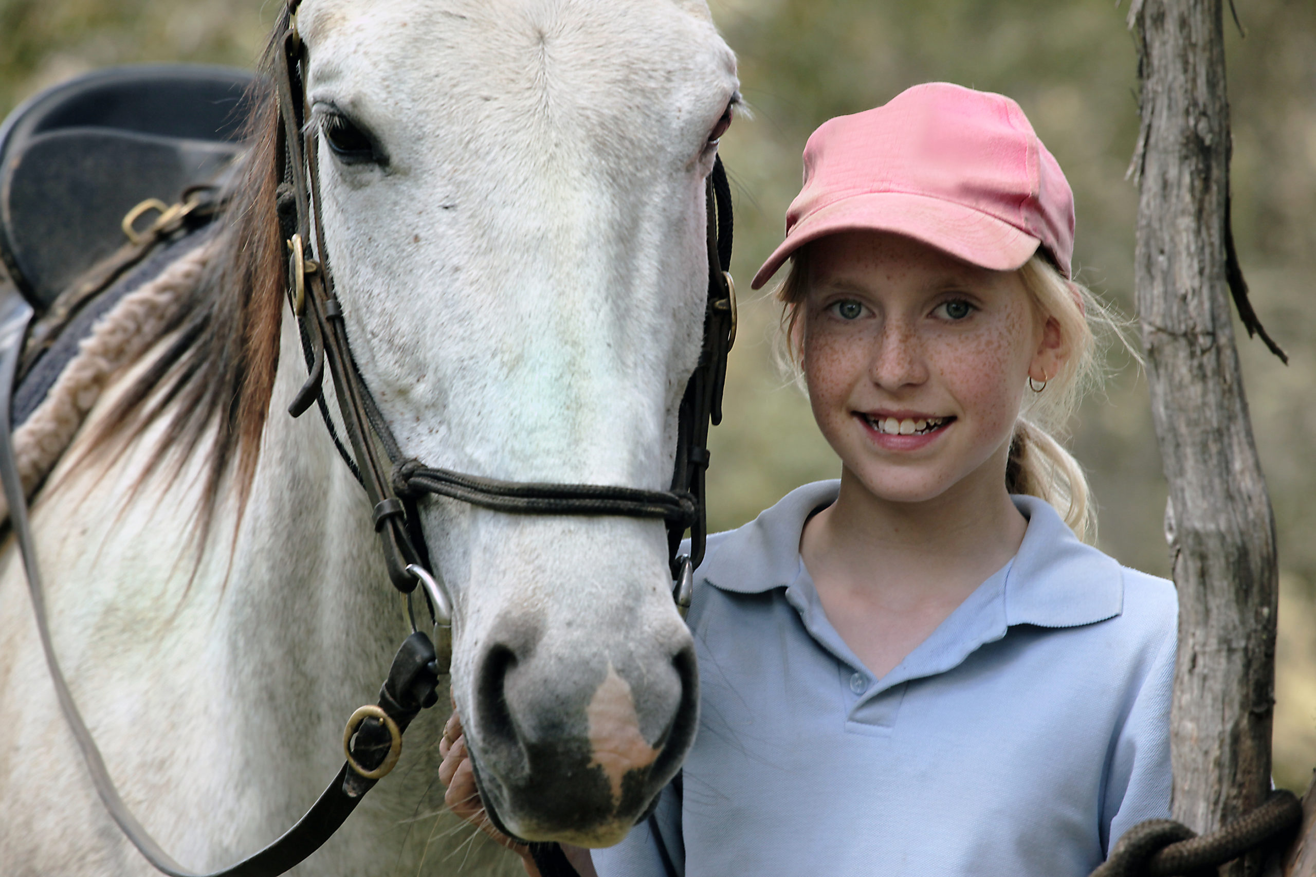
Tahoe Donner Equestrian Center
Truckee, CA15275 Alder Creek Road, Truckee, CA 96161Offers trail rides, pony rides, horse boarding, riding lessons, tack shop, Horsemanship Camps and BBQ Rides.
-

Diamond Oaks Golf Course
Roseville, CA349 Diamond Oaks Road, Roseville, CA 95678Diamond Oaks offers golfers of all levels an enjoyable golf experience.


