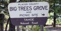
Big Trees Interpretive Trail Forest View Trail
The trail winds through old growth forest. Notice the many trees of different sizes, ages, and species. If you happen to visit during the spring, wildflowers are plentiful along the trail.
The trail winds through old growth forest. Notice the many trees of different sizes, ages, and species. If you happen to visit during the spring, wildflowers are plentiful along the trail. This short trail offers scenic views and is easy enough to be enjoyed by the whole family. The trail intersects with the Placer County Big Trees trail. Pick up a self-guided, interpretive brochure of the Big Trees Trail at either the Foresthill Ranger Station (on Foresthill Rd 1.2 miles before you get to Mosquito Ridge Rd) or the California Welcome Center in Auburn. The entire length of both trails is approximately 1½ miles. There is a picnic area adjacent to the upper parking lot with tables, BBQs, piped water, and restrooms available.
- Distance Forest View: .5 mile; Big Trees: 1 mile Loop
- Difficulty Easy
- Website Big Trees Interpretive Trail Forest View Trail
- Best Feature The Big Trees Picnic Area is located near the trailhead
- Hiking
- Picnic Area
- Scenic Views

From Foresthill, take the Mosquito Ridge Road (Road 96) approximately 24 miles to the Placer Big Trees turnoff, and turn right. The picnic area and trailhead are one half mile from this turn.
ALSO CHECK OUT:
-

Lewis Campground
Foresthill, CAMosquito Ridge Road 96, Foresthill, CA 95631This campground has 40 sites with tables and grills. There are toilets and potable water, as well as a boat launch.
-
Tahoe Rim Trail Mountain Biking
Kings Beach, CA100 Lake Parkway, Stateline, NV 89449The Tahoe Rim Trail offers some of the best riding anywhere.
-
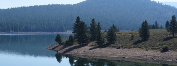
Prosser Creek Reservoir
Truckee, CAProsser Dam Road, Truckee, CA 96161Situated in a forested paradise, Prosser Creek Reservoir offers a premiere fishing spot, and provides plenty of Sierra outdoor recreation for all ages.


