Sugar Pine Trail
The Memorial Trail follows the shore around Sugar Pine Reservoir.
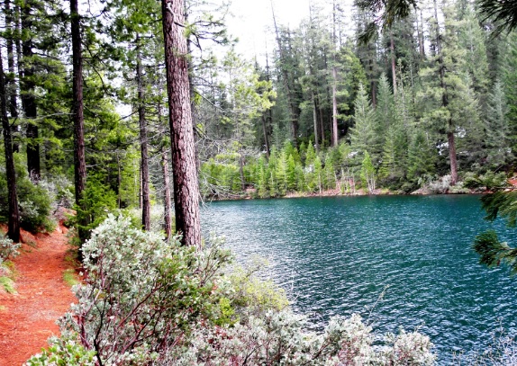
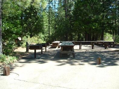
The Memorial Trail follows the shore around Sugar Pine Reservoir. If you begin in the picnic area, the first mile of the trail, to the Shirttail Creek Bridge, is suitable for wheelchairs. This part of the trail also has an interpretive brochure available in the box during the summer months or at the Ranger Station. Once you cross Shirttail Creek, the trail easily winds its way along the shore with plenty of good spots for fishing, swimming, or just taking a break. You will cross one more bridge, over Forbes Creek, and then pass the boat ramp and travel approximately one mile to the dam. The trail continues along the shore and will bring you back to the picnic area. There are picnic tables, BBQs, restrooms, and water available during the summer months. There are no fires or BBQs allowed around the lake, except in the facilities provided at the picnic area and campgrounds.
- Distance 3.5 miles each way
- Difficulty Easy
- Website Sugar Pine Trail
- Best Feature Once you cross Shirttail Creek, the trail easily winds its way along the shore with plenty of good spots for fishing, swimming, or just taking a break
- Hiking
- Fishing
- Picnicking

From Interstate 80, take Foresthill exit to Foresthill Road and proceed 15.5 miles to the Foresthill Ranger Station. Continue 10 miles to Sugar Pine Road and turn left. Continue approximately 5 more miles. The trail may be accessed from the boat ramp parking lot, the dam, or Manzanita picnic area. Note: there is a parking fee at the boat ramp and picnic area parking lots, usually from May to September, when the recreation facilities are open.
ALSO CHECK OUT:
-
Forbes Creek Group Campground
Foresthill, CASugar Pine Road, Foresthill, CA 95631Forbes Creek Group Campground is located on the southeast shore of Sugar Pine Reservoir in a cedar and pine forest overlooking the reservoir. It is near the North Fork of the American River with access to trails and swimming.
-
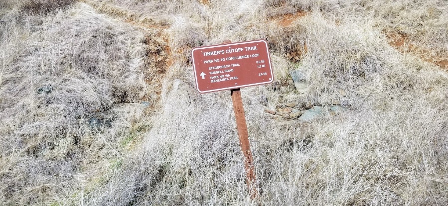
Tinker’s Cutoff Trail
Auburn, CAOld Foresthill Road, Auburn, CA 95603This single file trail offers an alternative route to and from Stagecoach Trail from the confluence area.
-

Morgan Creek Golf Club
Roseville, CA8791 Morgan Creek, Lane Roseville, CA 95747The golf program, like all the activities at Morgan Creek, is built around families.


