Pointed Rocks Trail
This steep trail offers great bird’s eye views of the confluence and American River canyons.
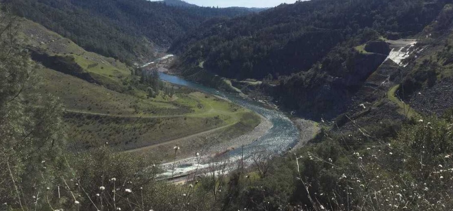
This steep trail offers great bird’s eye views of the confluence and American River canyons. On clear days, it offers sweeping views of the Sacramento Valley to the west and the Sierras to the east. Its steep gradient offers a good aerobic workout, climbing 1000 ft in 1.2 miles. It follows a buried telephone cable on its ascent from the confluence area to the ridge and the Olmstead Loop. After reaching the ridge, the trail passes through open, rolling hills and meadows dominated by several species of oaks, and wildflowers in the spring. Limestone outcroppings at the top give the trail its name.
- Distance 1.6 miles one way. This does not include distance to trailhead. A variety of loop options are available.
- Approx length of time 1½ hours up, ¾ hours down (hiking)
- Difficulty Moderate to Difficult
- Website Pointed Rocks Trail
- Best Feature The Pointed Rocks Trail is sometimes referred to as “The Training Hill” on trail markers since it offers a great workout for endurance runners and equestrians.
- Hiking
- Equestrian
- Steep Gradients

Trailhead is on Hwy 49, 1¾ miles south of ASRA Park Headquarters. Take Hwy 49 south from Auburn towards Placerville. After crossing the American River, park on the right off the highway. Walk to trailhead through the green gate (#150).
ALSO CHECK OUT:
-

Lake Tahoe Parasailing
Tahoe City, CA700 North Lake Boulevard, Tahoe City, CA 96145The company offers a full selection of recreational water sports activities, including parasailing flights and personal watercraft rentals.
-

The Links at Everline
Olympic Valley, CA400 Squaw Creek Road, Olympic Valley, CA 96146Surrounded by six majestic Sierra peaks, the Links at Everline is a championship golf course that sits serenely at the base of Olympic Valley | Alpine Meadows near Lake Tahoe, California.
-

Peninsula Camping & Boating Resort
Colfax, CA21597 You Bet Road, Chicago Park, CA 95945Come for a weekend or stay for a week, with great fishing, water sports, boating, biking or just sitting around the campfire.


