


Windy Point Trail
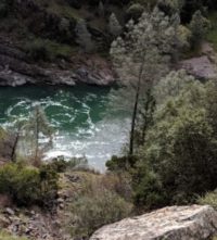
This short but challenging trail affords some spectacular views of the North Fork Canyon and when timing is right a spectacular wildflower display.
This short but challenging trail affords some spectacular views of the North Fork Canyon and when timing is right a spectacular wildflower display. The trail traverses sections where the whole hillside is carpeted with blue, yellow, purple, and gold wildflowers highlighted against a blue sky, and green hills dominated by oaks and gray pine. In spring, it is a photographer’s and wildflower lover’s delight. Caution: watch for poison oak, as it thrives along the trail.
- Distance 1.5 miles one way
- Approx length of time ¾ hour
- Difficulty Moderate to difficult. Trail is narrow, with loose rock and steep drop-offs
- Website Windy Point Trail
- Best Feature Windy Point Trail provides access to some beautiful and steep river canyon scenery
- Hiking
- Canyon Scenery
- Waterfall

Trailhead is on Iowa Hill Road. From Auburn, take I-80 east to Colfax. Exit at the Colfax, Grass Valley, Hwy 174 Exit. Go right at the exit; at the stop sign, turn right onto Canyon Way. In approx. 0.3 miles, turn left on Iowa Hill Road. Drive approx. 3.1 miles down Iowa Hill Road and across the North Fork American River. After crossing the bridge, continue for approx. 0.8 miles through the small camping area and up the road towards Iowa Hill. Several large boulders and a very small sign that simply says “trailhead” mark the trail. There is limited parking on the right shoulder just before and at the trailhead as the road bends to the left and away from the river. Caution: Iowa Hill is a narrow paved road with no guardrail. Drive slowly and watch for approaching vehicles since some places are barely wide enough for two vehicles to pass.
ALSO CHECK OUT:
-
Confluence Interpretive Trail
Auburn, CAHighway 49 S, across from ASRA Park HQ, Auburn, CA 95603The confluence of the North and Middle Forks American River affords a marvelous opportunity to view the natural wonders of this river canyon environment and to glimpse the past via the remains of its historic bridges.
-

Tahoe Whitewater Tours
Truckee, CA10015 Palisades Drive, Truckee, CA 96161Our trips are suitable for kids, families, large groups, small groups, parties, corporate groups and to anyone looking to get our and have some fun. If your looking for one of the best ways to spend a day this summer look no further. Our operation focus heavily on safety, comfort and good old fashioned fun!
-

Confluence Trail
Auburn, CAOld Foresthill Road, Auburn, CA 95603Confluence Trail is a 3.5 mile out and back trail located near Auburn, California that features a river and is good for all skill levels. The trail is primarily used for hiking, walking, and mountain biking and is accessible year-round. Dogs are also able to use this trail but must be kept on leash.


