North Fork of the Middle Fork Trail
Although it is primarily used by people placer mining along the river, other hikers are drawn to this area due to its easy grade, scenic beauty, and year round accessibility.
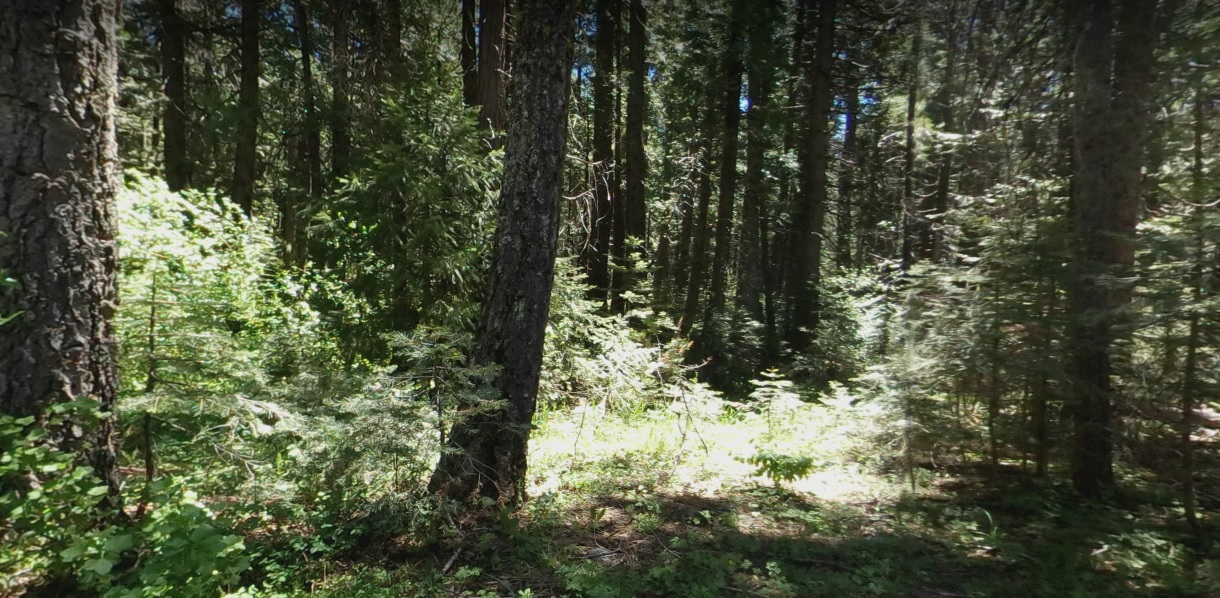
This trail runs upstream along the North fork of the Middle Fork of the American River. Although it is primarily used by people placer mining along the river, other hikers are drawn to this area due to its easy grade, scenic beauty, and year round accessibility. This trail is a wonderful choice for early or late season hikes, with wildflowers plentiful during spring. The trail increases to a moderate slope, but levels out after the first quarter mile, until it drops down to the river. Good fishing is available at times, and river access with limited camping is possible along the trail. Campfire permits are required for campfires, backpacking stoves, BBQs and lanterns. Poison Oak is commonly seen in the canyon and along the trail.
- Distance 1.03 miles each way
- Difficulty Easy
- Website North Fork of the Middle Fork Trail
- Best Feature This trail is a wonderful choice for early or late season hikes, with wildflowers plentiful during spring
- Hiking
- Biking
- Equestrian

Trailhead Access: From Interstate 80, take the Foresthill exit to Foresthill Road and proceed 15.5 miles to the Foresthill Ranger Station. Continue 1.2 miles and turn right onto Mosquito Ridge Road. Travel approximately 9 miles to where you will see the trail sign on the left after crossing the bridge. Park on the right side of the road and then cross the road to the trailhead.
ALSO CHECK OUT:
-
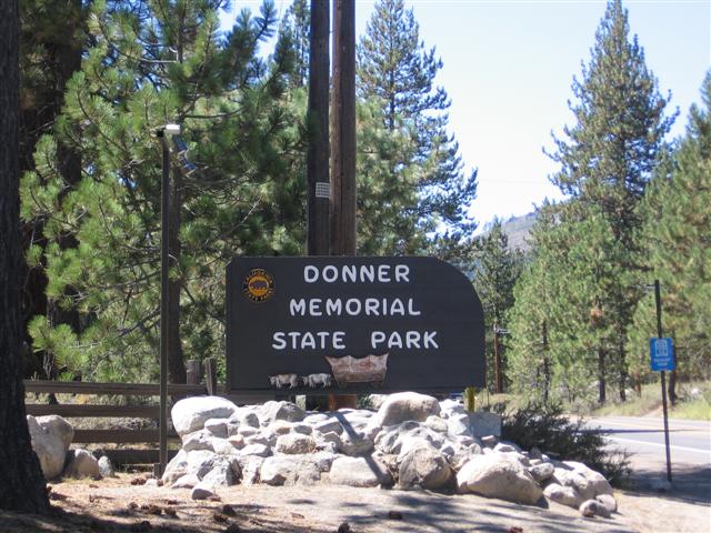
Donner Memorial State Park & Emigrant Trail
Truckee, CA12593 Donner Pass Road, Truckee, CA 96161The park is home to numerous hiking and snowshoeing trails, or you can swim, boat and fish.
-

Nyack Snow Park
Emigrant Gap, CA41965 Nyack Road, Emigrant Gap, CA 95715WINTER FUN IN THE SNOW
Bring your favorite sled, saucer or tube, and hit the hills for some winter fun. We have a variety of gentle to fun slopes and winding paths for everyone to enjoy. -
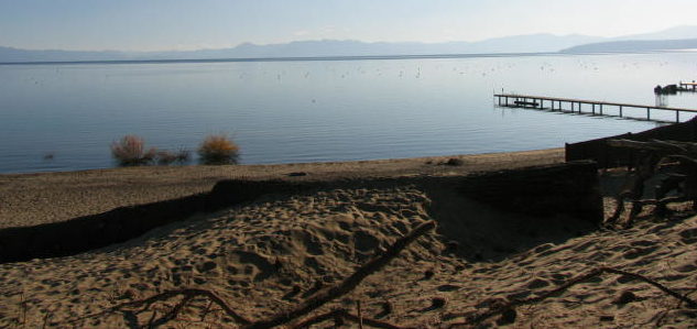
Moon Dune Beach
Tahoe Vista, CA7010 North Lake Boulevard, Tahoe Vista, CA 96148Moon Dune Beach is the finest white sand beach in Lake Tahoe.


