Quarry & Western States Loop Trail
This loop affords regular users of the Quarry Trail an alternate route rather than the normal out and back.
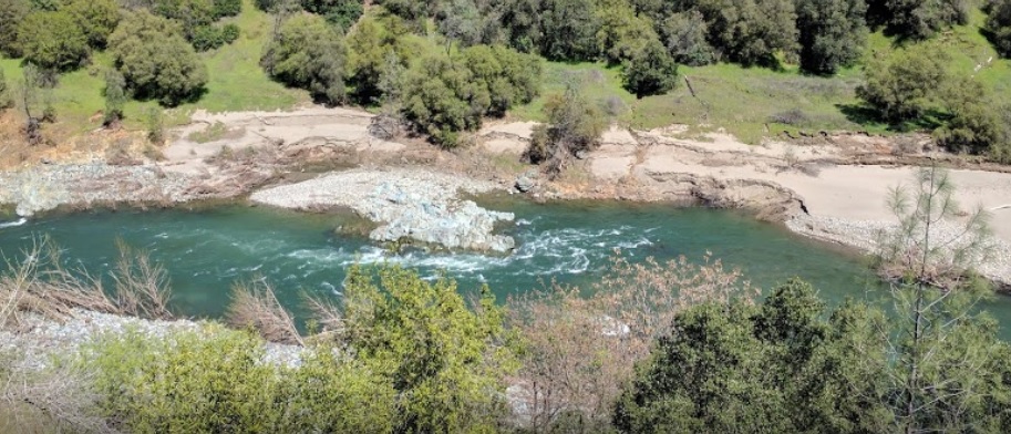
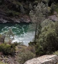
The Quarry Trail portion of this loop follows the wide, level bed of the Mountain Quarries RR. It affords nice views of the Middle Fork American River. The two sections of the Western States Trail (WST) cut through the dense foothill woodlands above the river. This loop affords regular users of the Quarry Trail an alternate route rather than the normal out and back. It highlights a small portion of the WST while skirting the quarry operation. The loop goes from river to canyon rim and back. Trails Included: Quarry Trail, Western States Trail-Tevis (portion), Western States Trail (portion), Shortcut Trail 1 (optional).
- Distance 6.3 miles
- Approx length of time 3 hours (hiking)
- Difficulty Moderate to Difficult
- Website Quarry & Western States Loop Trail
- Best Feature Beautiful views of the Middle Fork American River
- Hiking
- Biking
- Equestrian

Trailhead is 2 miles south of ASRA Park Headquarters. Take Hwy 49 south from Auburn; turn right across the American River towards Cool. Turn left on a small dirt road ¼ mile south of the river crossing. Trailhead is beyond the parking area at green gate (#151).
ALSO CHECK OUT:
-

Indian Creek Country Club
Loomis, CA4487 Barton Road, Loomis, CA 95650At Indian Creek, we have all the amenities; a challenging par 32 golf course that is nestled among beautiful valley oaks and dotted with granite outcroppings.
-

Boreal Mountain Resort
Norden, CA19749 Boreal Ridge Road, Soda Springs, CA 95728There is never a dull day as the resort offers so many different activities.
-
Confluence Interpretive Trail
Auburn, CAHighway 49 S, across from ASRA Park HQ, Auburn, CA 95603The confluence of the North and Middle Forks American River affords a marvelous opportunity to view the natural wonders of this river canyon environment and to glimpse the past via the remains of its historic bridges.


