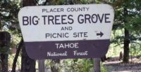
Big Trees Interpretive Trail Forest View Trail
The trail winds through old growth forest. Notice the many trees of different sizes, ages, and species. If you happen to visit during the spring, wildflowers are plentiful along the trail.
The trail winds through old growth forest. Notice the many trees of different sizes, ages, and species. If you happen to visit during the spring, wildflowers are plentiful along the trail. This short trail offers scenic views and is easy enough to be enjoyed by the whole family. The trail intersects with the Placer County Big Trees trail. Pick up a self-guided, interpretive brochure of the Big Trees Trail at either the Foresthill Ranger Station (on Foresthill Rd 1.2 miles before you get to Mosquito Ridge Rd) or the California Welcome Center in Auburn. The entire length of both trails is approximately 1½ miles. There is a picnic area adjacent to the upper parking lot with tables, BBQs, piped water, and restrooms available.
- Distance Forest View: .5 mile; Big Trees: 1 mile Loop
- Difficulty Easy
- Website Big Trees Interpretive Trail Forest View Trail
- Best Feature The Big Trees Picnic Area is located near the trailhead
- Hiking
- Picnic Area
- Scenic Views

From Foresthill, take the Mosquito Ridge Road (Road 96) approximately 24 miles to the Placer Big Trees turnoff, and turn right. The picnic area and trailhead are one half mile from this turn.
ALSO CHECK OUT:
-
Blackwood Canyon
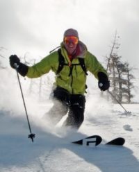
Tahoe City, CACalifornia 89, Tahoe City, CA 96150Blackwood Canyon is the West Shore’s most prominent canyon, holding so many zones that one would need a month of exploration to ski it all.
-

Peninsula Camping & Boating Resort
Colfax, CA21597 You Bet Road, Chicago Park, CA 95945Come for a weekend or stay for a week, with great fishing, water sports, boating, biking or just sitting around the campfire.
-
Tributary Whitewater Tours
Auburn, CA20390 Paoli Lane, Colfax CA 95713We look forward to helping you plan a wonderful American River Rafting trip.


