Burton Creek State Park
Six miles of unpaved roadway are available for hiking, mountain biking, and cross-country skiing.
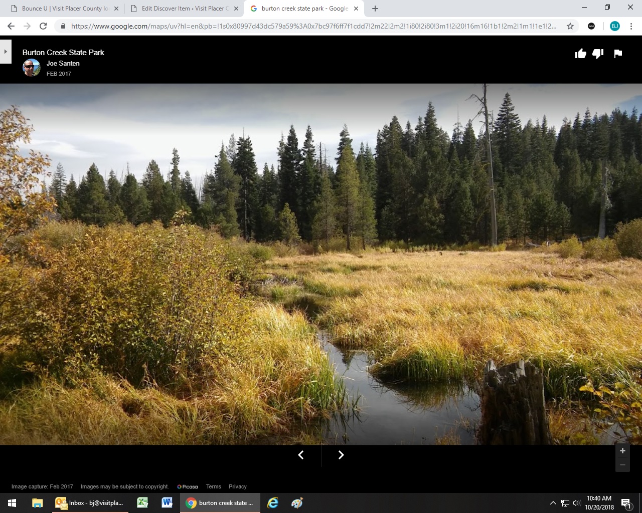
Six miles of unpaved roadway are available for hiking, mountain biking, and cross-country skiing. The terrain is mountainous and uneven and explores the south facing slopes of the north shore of the Tahoe Basin. There is a variety of conifers and shrubs, and opportunities for wildlife and bird watching. Spring time offers many wildflowers to see, and in the fall the cottonwoods change color. In the winter, the trails are open for cross-country skiing. For more information please contact Tahoe XC. Water, restrooms, and other services are not available. Motorized vehicles are not allowed in the park.
- Hours Sunrise to Sunset
- Address Burton Creek State Park is located on the northeast side of Tahoe City. Please review the park brochure for access areas.
- Phone 530-525-7232
- Website Burton Creek State Park
- Best Feature In the winter, the trails are open for cross-country skiing
- Hiking
- Mountain Biking
- Skiing

The park is located on the northeast side of Tahoe City.
ALSO CHECK OUT:
-
North Tahoe Beach Center
Kings Beach, CAState Route 28 at Highway 267, Kings Beach, CAThe park includes a grassy area located above the beach; shoreline access; permanent restrooms; one horseshoe pit (bring your own shoes!); barbecues and picnic tables; and three popular, high quality beach volleyball courts.
-

Cinemark Roseville Galleria
Rocklin, CA6692 Lonetree Blvd., Rocklin, CA 95677Easy access to parking.
-
North Shore Parasailing
Tahoe Vista, CA8290 North Lake Boulevard, Kings Beach, CA 96148Come experience a breathtaking view of Lake Tahoe and the thrill of a lifetime parasailing with North Shore Parasail!


