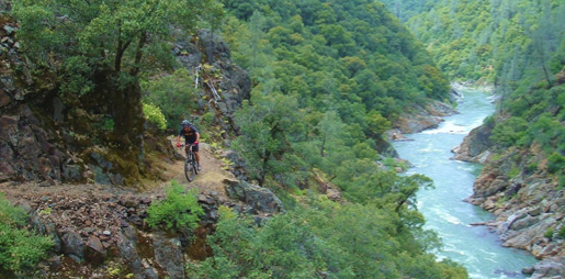
Green Valley Trail
From Interstate 80, take the Foresthill exit to Foresthill Road and proceed 15.5 miles to the Foresthill Ranger Station
From Interstate 80, take the Foresthill exit to Foresthill Road and proceed 15.5 miles to the Foresthill Ranger Station. Continue 10 more miles to Sugar Pine Road (Forest Road 10). Follow it for 5 miles until you cross Sugar Pine Dam. One mile beyond the dam, turn right on to Elliot Ranch Road, which is the dirt road just past the paved road to the campground. Travel 3 miles to the signed trailhead and make a left. NOTE: The road is rocky and a high clearance vehicle is advised.
- Distance 2.62 miles each way
- Difficulty Difficult
- Website Green Valley Trail
- Best Feature Good fishing is available at times, and river access with limited camping is possible along the trail
- Hiking
- Biking
- Fishing

From Interstate 80, take the Foresthill exit to Foresthill Road and proceed 15.5 miles to the Foresthill Ranger Station. continue 10 more miles to Sugar Pine Road (Forest Road 10). Follow it for 5 miles until you cross Sugar Pine Dam. One mile beyond the dam, turn right onto Elliot Ranch Road, which is the dirt road just past the paved road to the campground. Travel 3 miles to the signed trailhead and make a left. NOTE: The road is rocky and a high clearance vehicle is advised.
ALSO CHECK OUT:
-
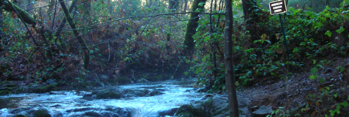
American Canyon Trail
Greenwood, CAGreenwood Road @ Pilgrim Court, Greenwood, CA 95635This steep trail has everything needed for a great day of exploration: rugged mountain canyons, a beautiful stream with waterfalls, a wide variety of plant and animal life, gold rush era history, and panoramic views of the Middle Fork American River.
-
Garcia’s Hunting Preserve
Lincoln, CADowd Road, Lincoln, CA 95648Offer a variety of hunts ranging from upland game hunts to big game hunts.
-
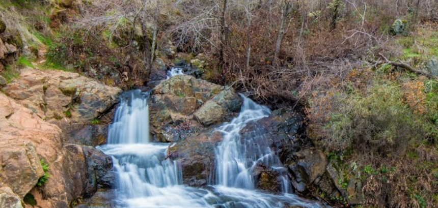
Hidden Falls Regional Park
Auburn, CA7587 Mears Place, Auburn, CA 95602Waterfalls and sweeping views of the Sacramento Valley and the Sutter Buttes.


